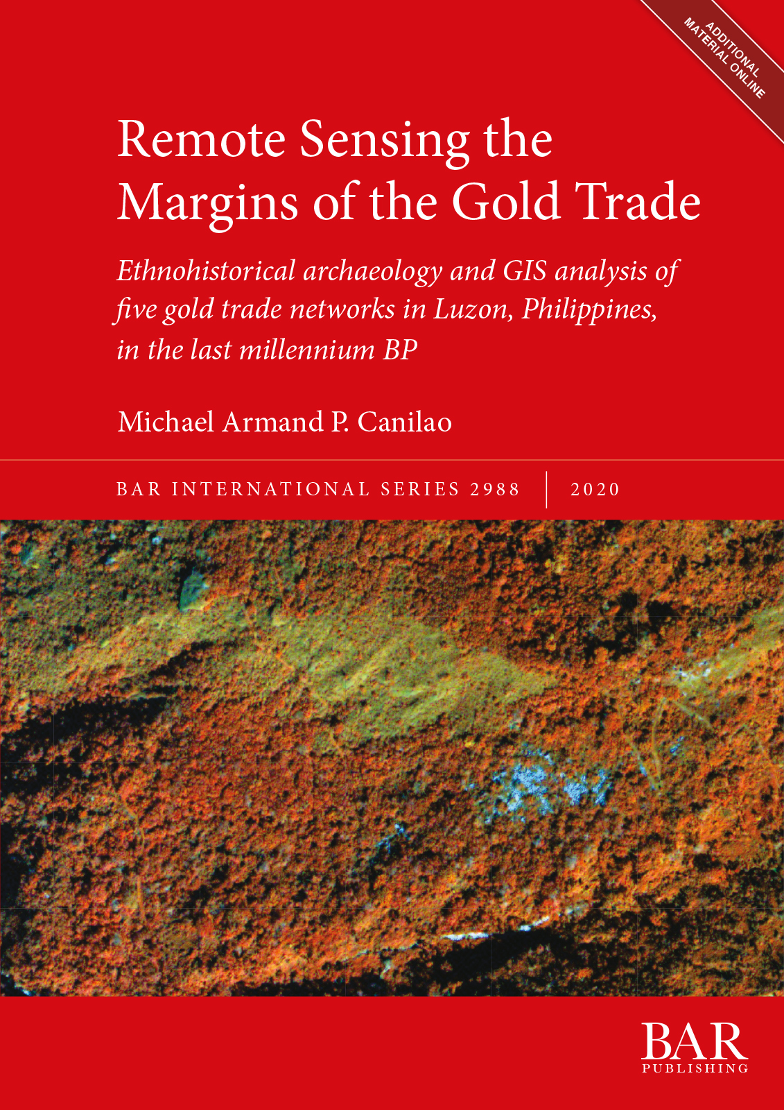
Remote Sensing the Margins of the Gold Trade
Ethnohistorical archaeology and GIS analysis of five gold trade networks in Luzon, Philippines, in the last millennium BP
Written by Michael Armand P. Canilao
£30.00 – £38.00
Description
Gold studies on the Indian Ocean- West Philippine/ South China Sea world system have tended to focus on global and often homogenous patterns in the fields of archaeology and history. However, there is increasing interest in pursuing the gold studies by starting from the putative ‘peripheries’ from where gold nuggets were mined in crude tunnels or panned in streams. Remote Sensing the Margins of the Gold Trade shows how Igorot societies negotiated their peripherality in the expansive porcelain-for-gold exchange system that was creeping onto their shores. The research looks at how the Igorot miners practiced their agency through their participation in tabu-tabuans or evanescent market encounter at the coastal trading centers. The findings are based on multiscalar and multidisciplinary analyses using regional GIS data, high resolution multispectral satellite remote sensing data, ethnographic data, primary and secondary written historical data, archival maps and images, oral tradition data, and archaeological data on the Early Historical to Historical period.
About the Author
Michael Armand P. Canilao is Associate Professor with the Archaeological Studies Program, University of the Philippines Diliman (UPD). He completed his Doctorate in Anthropology at the University of Illinois in Chicago. In studying early gold, he utilises multiscalar and regional approaches including remote sensing systems and geographic information systems.Reviews
‘The author’s use and corroboration of historical, anthropological, and archaeological sources as well as the GIS and RS know-how makes a case for the viability of interdisciplinary research and collaboration and its ability to provide a more nuanced understanding of our past. Canilao’s research brings out the forgotten voice of those from the past, which have long remained in the margins, both in the temporal and spatial sense.’ Marco Stefan B. Lagman, Social Science Diliman, Volume 17(2), 2021 ‘This project is terrific: its incorporation of historical texts, historical photographic images, and satellite data and GIS analysis of terrain and trails is excellent, original, and well presented.’ Dr Robert E. Murowchick, Boston University ‘This is a unique treatment of the role of gold in Philippine history and maritime exchange during the early modern period.’ Dr Stephen Acabado, UCLAYou might also like...
-
The Urban History of Tarquinia based on Geomagnetic Surveys
Attilio Mastrocinque and Fiammetta SorianoPrint Book £45.00
PDF eBook £35.00 -
The Medieval Alps
Paolo ForlinPrint Book £79.00
PDF eBook £62.00 -
The Archaeology of Hassanamesit Woods
Stephen Mrozowski and Heather Law PezzarossiPrint Book £60.00
PDF eBook £46.00 -
Computer Applications and Quantitative Methods in Archaeology 1994
Jeremy Huggett and Nick RyanPrint Book £61.00
PDF eBook £47.00 -
Hidden Landscapes of Mediterranean Europe
Martijn van LeusenPrint Book £75.00
PDF eBook £58.00
